A New Chapter: Planning for the Future of the South Mountain House
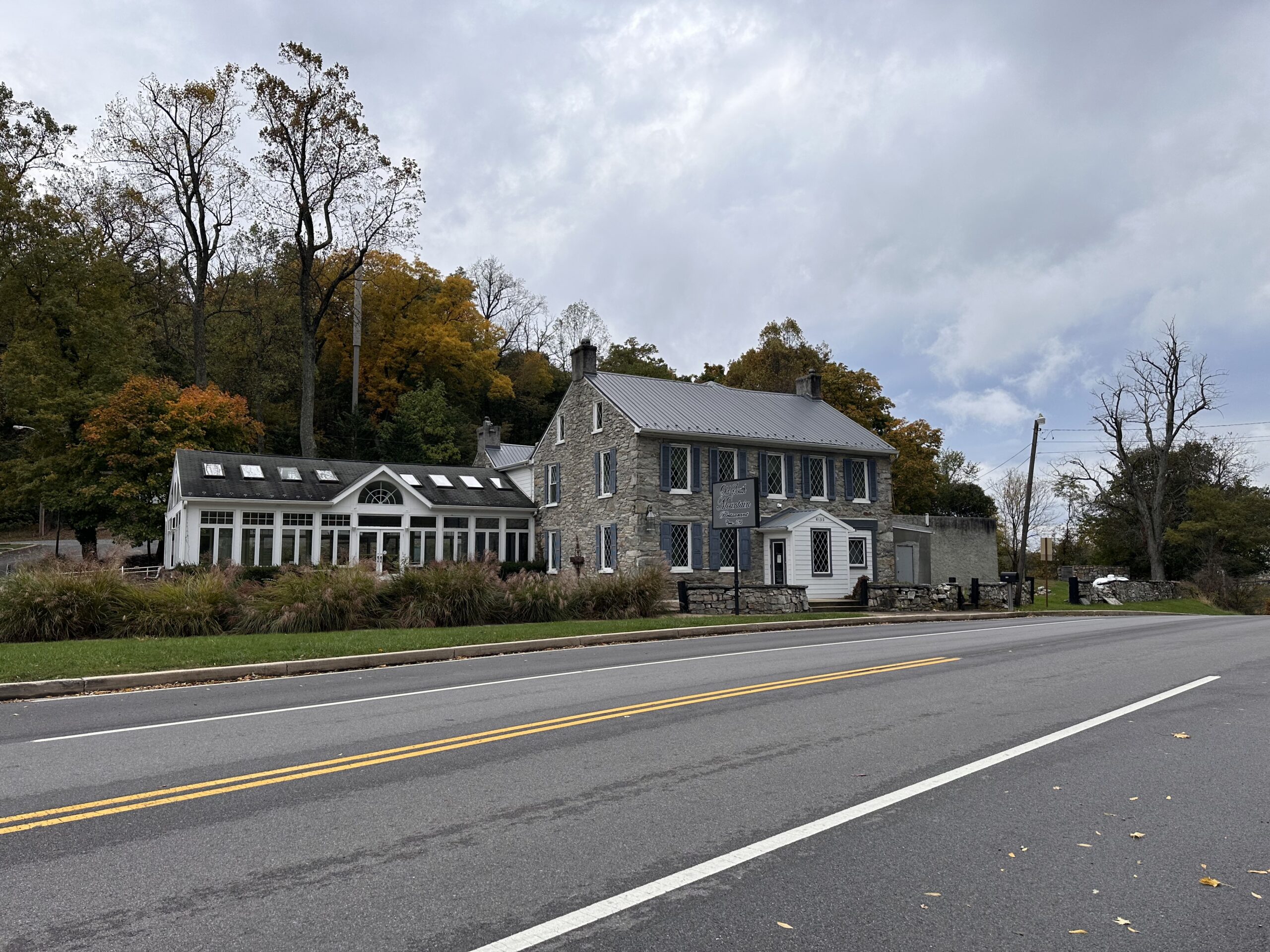
Traveling along Alternate U.S. Route 40, part of the Historic National Road Scenic Byway, travelers may be surprised to encounter the South Mountain House—known most recently as the “Old South Mountain Inn”—rising unexpectedly from the landscape. Previous histories date the awe-inducing building to the late 1700s, and a new study suggests a later origin, but there is no doubt that it expanded over several periods. It has functioned as an inn and resort for both settlers and regular travelers, a tavern for locals and passersby in need of refreshment, a Civil War field hospital and temporary military headquarters, the country residence of an influential widow, a religious retreat for a Catholic sisterhood (or two!), and, for many years, a destination restaurant offering a distinctive dining experience. Now the house is potentially on its way to serving as a new visitor center for the South Mountain Recreation Area per its 2023 acquisition by the Maryland Department of Natural Resources – Maryland Park Service (DNR).
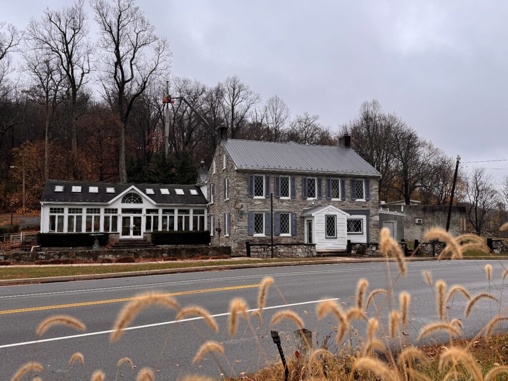
South Mountain House, November 2025
A Project at the Intersection of History and Recreation
Located in the Turner’s and Fox’s Gap Historic District, today’s 7,754 square feet South Mountain House and its surrounding land is the subject of a project that includes the completion of a historic structure report (HSR) and an adaptive reuse feasibility study. Both will provide essential guidance on how to balance the structure’s historic integrity with the practical requirements of its potential next chapter.
Since the house sits at an intersection of notable historic and recreational resources for both Frederick and Washington Counties—bordering the Appalachian National Scenic Trail, in close proximity to the Dahlgren Backpacking Campground, and near to Washington Monument and South Mountain State Parks—its location makes it a prime candidate for filling a visitor center role. Because several area groups and officials also see this potential, they will be consulted throughout the project to best consider community needs and knowledge on how to support and attract future visitors.
Documenting the Details: From High-Tech Scans to Archival Discovery
Bringing this project forward, Preservation Maryland is serving as project manager on behalf of DNR—the property owner—and is overseeing lead consultant Mesick Cohen Wilson Baker Architects, LLP (MCWB). MCWB has assembled a team of consulting architects, engineers, landscape and architectural historians, archaeologists, and other historic preservation practitioners to round out their expertise.
The project officially kicked off in September of 2025. Shortly after, the MCWB team traveled to the South Mountain House to document the site using a Matterport 3D camera, UAV drone photogrammetry, and laser scanning. The combination of methods collected various views of the building’s exterior, interior, and immediate surroundings.
*For a look into the South Mountain House, see the Matterport scan here.
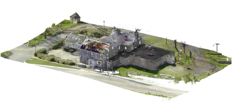
Point Cloud scan of the South Mountain House
Building on the above-gathered visuals of the house and existing documentation detailing the structure’s history—such as historic deeds, newspaper accounts, and books written about the property and immediate area—MCWB and its team of subconsultants returned to the site in November for further analysis and a conditions assessment.
- Armed with gloves, knee pads, flashlights, notepads and clipboards, team members investigated various nooks and crannies to review finishes, woodwork, nails, framing, and masonry.
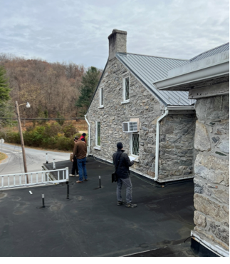
MCWB team members investigate a portion of the South Mountain House roof.
- Structural engineers cut pre-approved probes into limited areas where modern materials were present to examine changes over time.
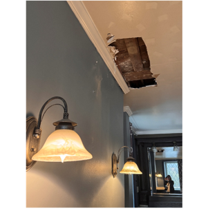
Probe cut into the ceiling in the first-floor lounge room.
- All existing mechanical, electrical, and plumbing systems were inspected.
- A hazardous materials team screened painted surfaces and other building materials.
- Paint samples were collected for historical paint analysis.
- Archaeologists performed excavations around the property.
- Landscape architects used hand-held GPS equipment and photography to thoroughly document the land surrounding the home, and made notes related to materials, conditions, and plant species found.
- A civil engineer inspected site constraints, access, existing storm system conditions, and other visible existing site features.
- And, in early December, a dendrochronologist came to the house to collect timber samples to determine wood type and approximate age.

DNR Historic Planner Pete Morrill shows MCWB’s Jeff Klee and Tom Burgess a particular detail in the front parlor of the South Mountain House.
With information collected, MCWB has created a timeline that frames the development of the South Mountain House in six distinct periods. Further analysis of field work will contribute to a detailed condition assessment report. These tools will play an imperative role in the historic structure report and the feasibility study.
The Road Ahead
There is a great deal the project team has learned—and more findings are rolling in! Their goal is to organize and present this information so that we are given a full picture of the awe-inspiring property before future phases of work can be pursued. With so many facets that make up the house and grounds, we’re excited to dive into the details in narrative form—we expect to have the historic structure report (HSR) in hand by this spring.
Following the delivery of the HSR, the team will begin the process of community engagement to ensure that voices have the chance to chime in on the planning process. As this structure stands as a testament to the community’s rich history, it is only natural to keep the community involved.
Stay tuned—we’ll provide further updates as the South Mountain House project progresses!