In this feature, Preservation Maryland is exploring the unique history of five county flags across the state
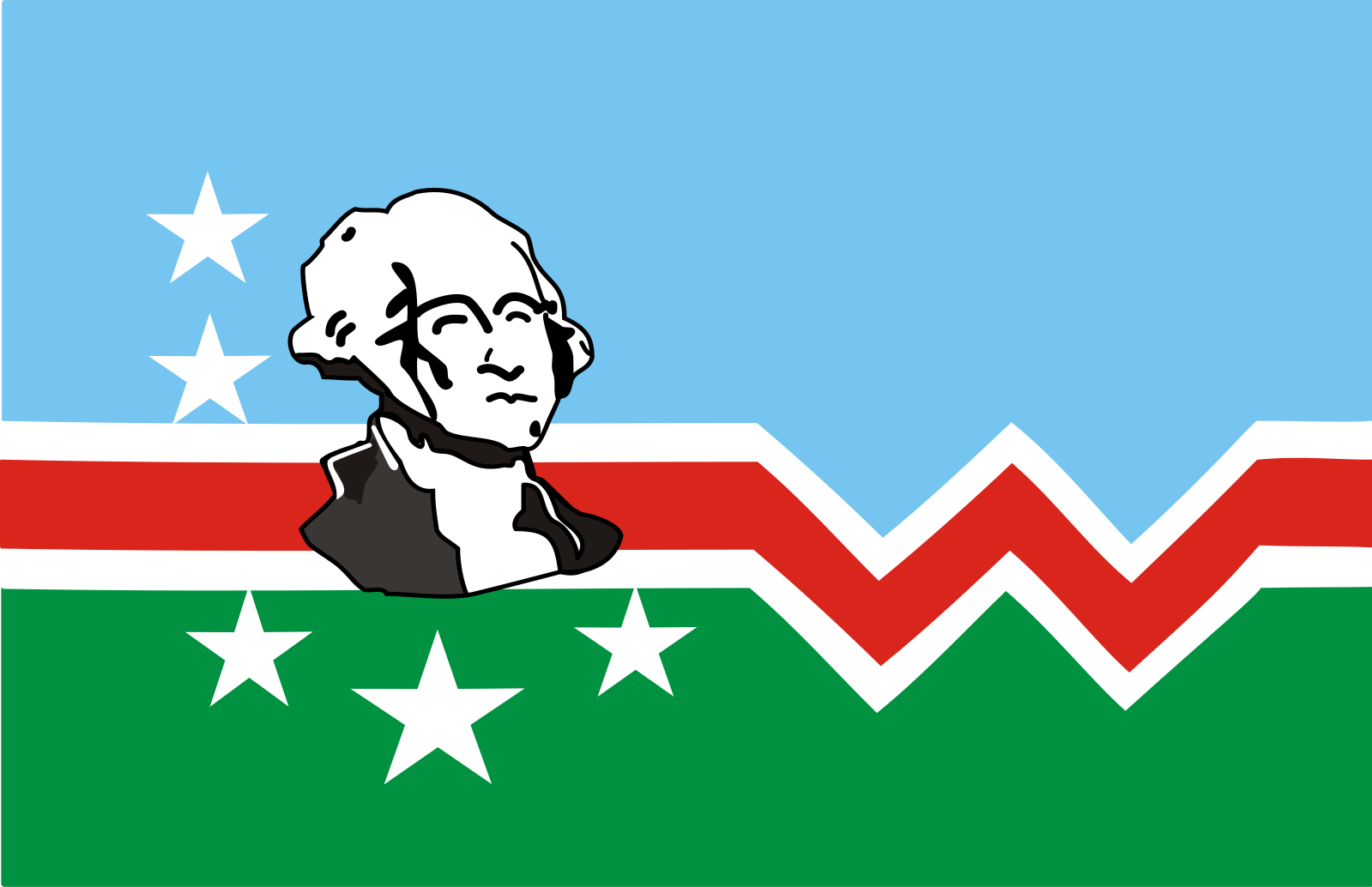
The Washington County flag, adopted in 1988, features a portrait of the county’s namesake, George Washington, on a green and blue background split by a bold, red “W.” Washington is surrounded by nine stars, one for each of the county’s incorporated towns. Hagerstown, the county seat, is represented by the largest star. The green and blue reflect the natural heritage of the county: fertile agricultural land, forests, mountains, and rivers.
The Early Development of Washington County
Washington County is located in the Cumberland Valley, nestled between the Blue Ridge and Allegheny Mountains. The first settlement in the county, Conococheague, dates to 1737 and was located across from present day Williamsport. The county was established in 1776 when Frederick County was split into Montgomery, Frederick, and Washington County. Originally, the borders of Washington County included what are now Allegany and Garrett Counties as well.
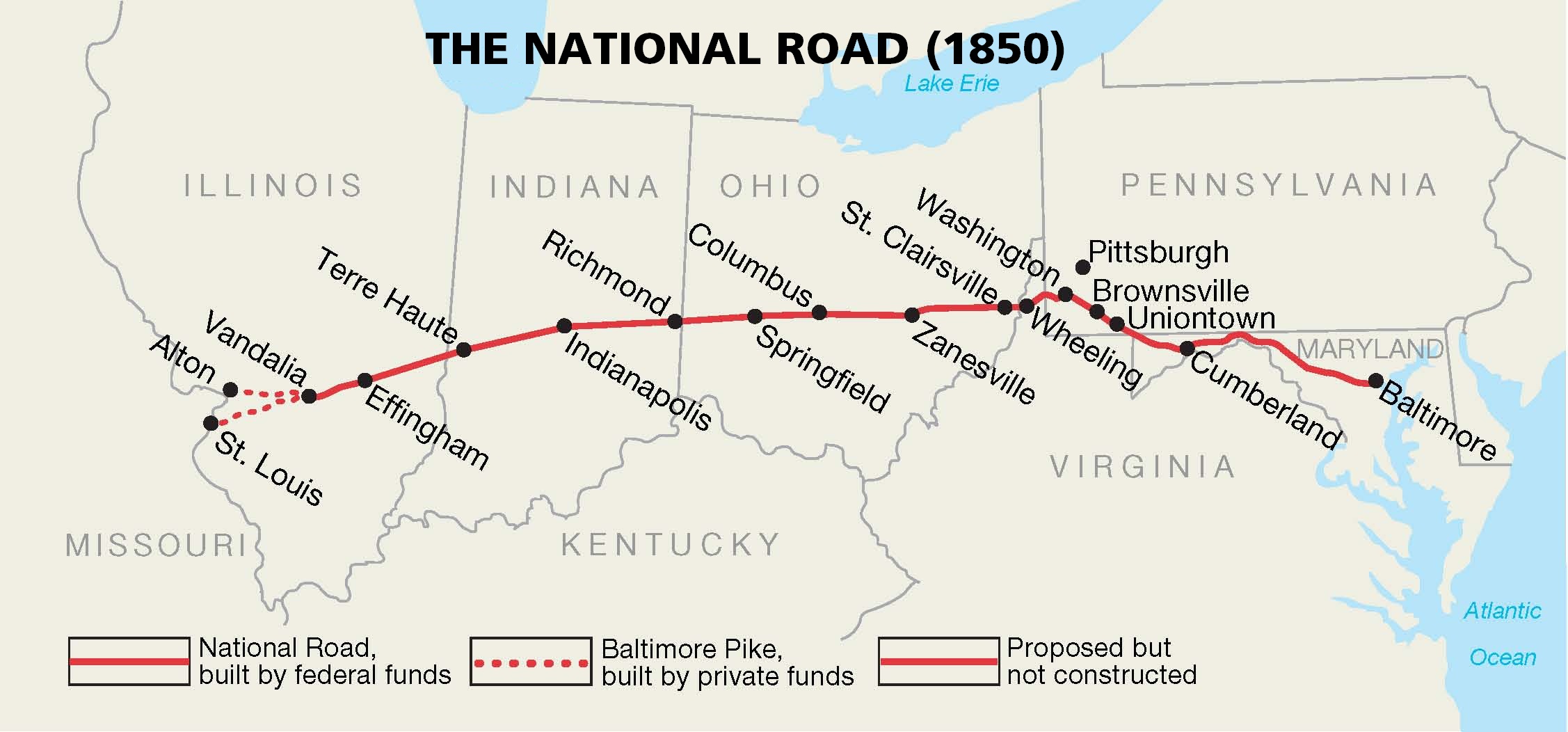
The National Road, built between 1811 and 1837, connected the region to Baltimore, Ohio, Indiana, and Illinois. One of the busiest roads in the country, It became a major trade route, making Washington County a center of commerce in Western Maryland. Industries quickly developed along the road including taverns, inns, tolls, and factories. The C&O Canal, constructed to expedite trade through the region, reached Washington County in 1834. However, construction of the B&O Railroad was also rapidly progressing during this time, ultimately reaching Sandy Hook that same year.
Washington County in the Civil War
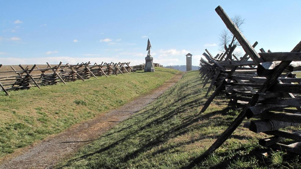
The region played a major role in the Civil War. Like the rest of Maryland, which was under martial law and did not secede from the Union, loyalties were split in Washington County. A narrow strip of Maryland separated Confederate Virginia from the free state of Pennsylvania, which made Hagerstown, the county seat, a critical transit and supply center. Washington County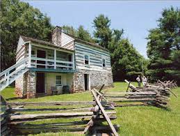 is home to the Kennedy Farm, where in 1859 John Brown, with assistance from other abolitionists, including Harriett Tubman, planned his raid on Harper’s Ferry. In 1862 the county was the site of the bloodiest single-day battle of the Civil War. The Battle of Antietam, also known as the Battle of Sharpsburg, was a turning point in the war and led President Abraham Lincoln to issue the Emancipation Proclamation, freeing all enslaved people in rebelling states.
African American History in Washington County
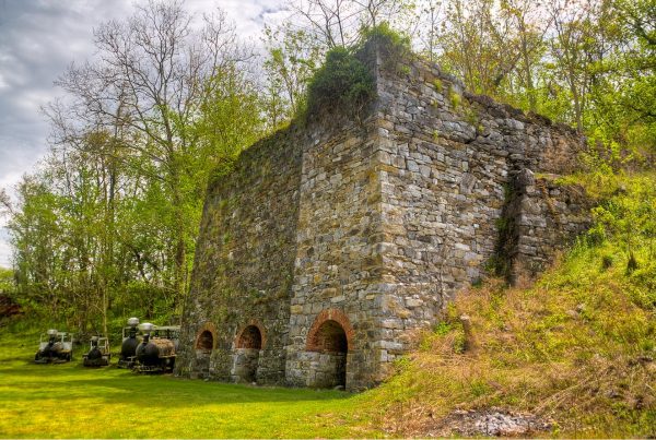
Washington County had significant enslaved and free populations. In 1860, at the start of the Civil War, there were 1,435 enslaved people recorded in the census along with 1,677 free Black people. The total population of the county at the time was 31,417. While fertile soil did make Washington County an ideal region for farming, iron working was also a major industry. Enslaved laborers were used for both. The Antietam Furnace, originally known as Frederick Forge, opened along Antietam Creek in 1768. The ironworks supplied goods to the American army during the Revolution and operated, with a brief closure in the 1860s, until 1880.
- Antietam Ironworks
- Antietam Battlefield
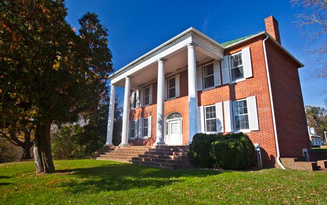
The proximity to Pennsylvania also made the county an important are for enslaved people seeking freedom in the North. Ferry Hill Plantation, near Sharpsburg, was used as an Underground Railroad stop and is included on the National Park Service’s Underground Railroad Network to Freedom.
- Ferry Hill Plantation
- Jonathan Street House
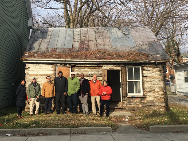
There are also a number of African American communities in Washington County. Historic Jonathan Street in Hagerstown is one of the oldest Black communities in Maryland. In 2020, Preservation Maryland purchased a historic building at 417 North Jonathan Street and is in the process of restoring it and turning it into owner-occupied affordable housing. The cabin was built in the 1830s, however, the timbers used in its construction date back to 1739.
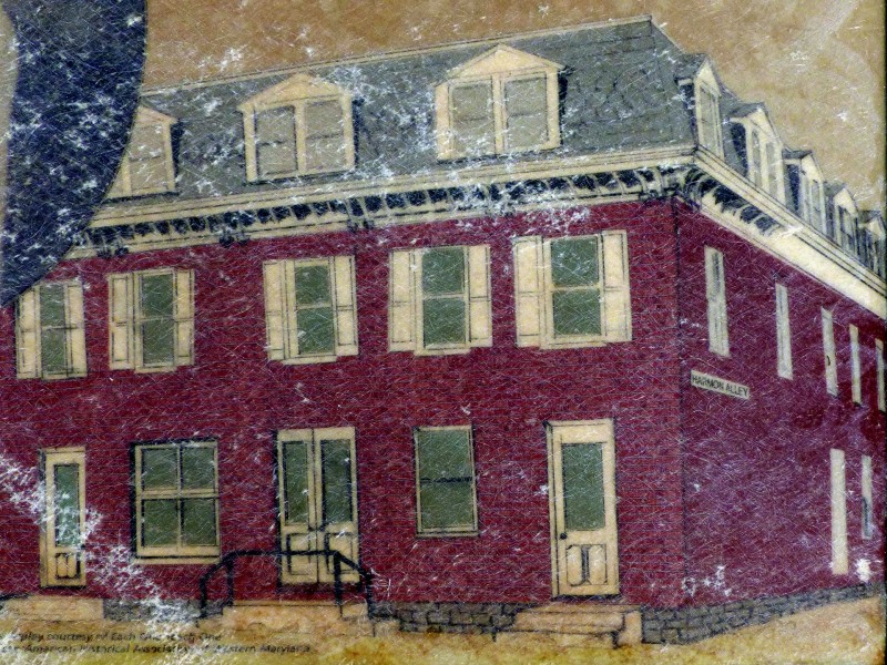
In the 20th century, Jonathan Street was also the home of a Green Book hotel. The Negro Motorists Green Book was a travel guide developed by Victor Hugo Green to safely guide Black travelers through the Jim Crow South. The Harmon Hotel on Jonathan Street was on such site. Owned by Walter Harmon, one of the wealthiest Black men in Hagerstown, it operated for over 40 years.
- Harmon Hotel
- Tolsons Chapel
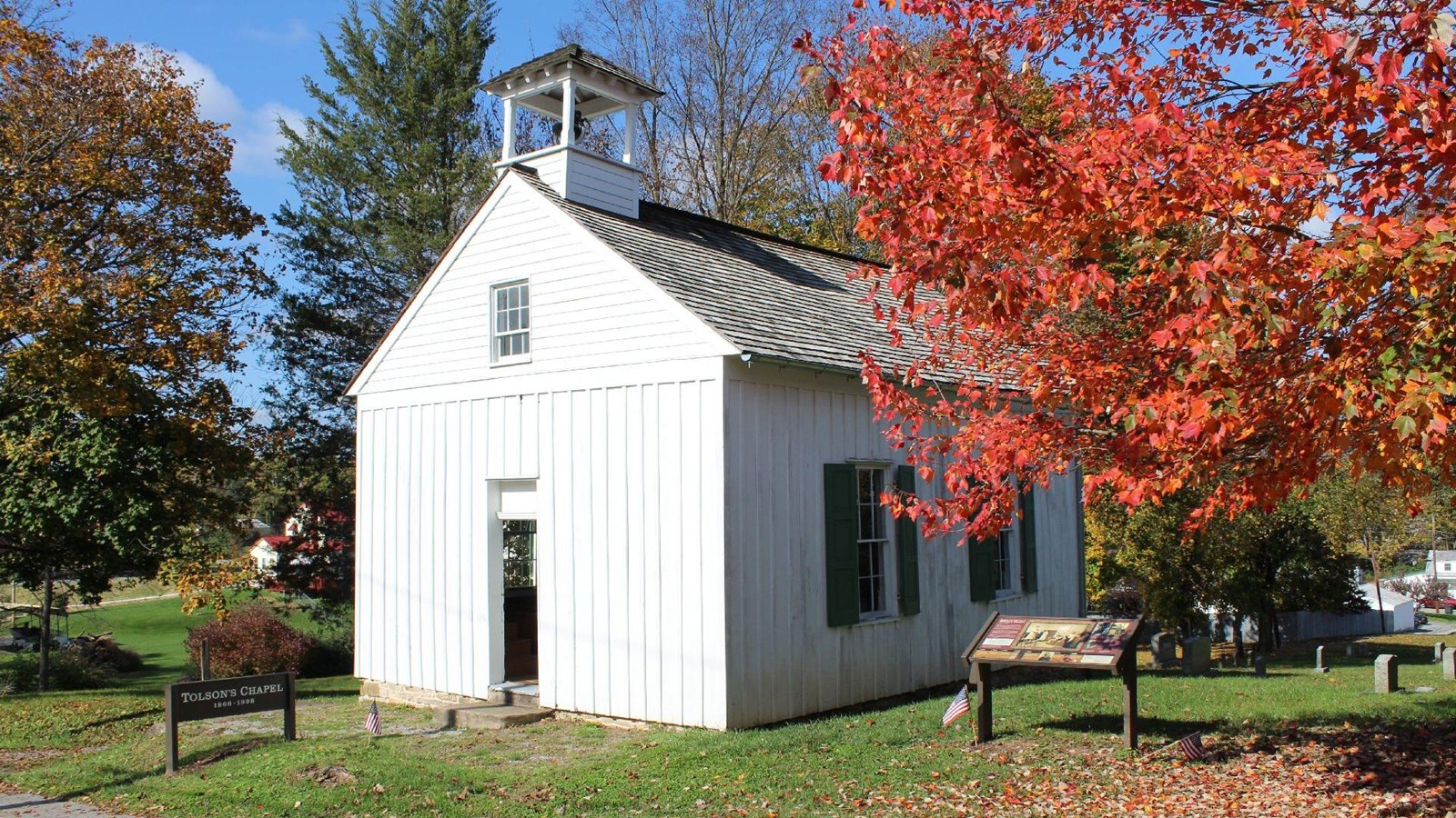
In nearby Sharpsburg, Tolson’s Chapel, a church and Freedmen’s Bureau School, is a centerpiece of the African American community. Built in 1866 on land donated by a local Black couple, it opened as a school in 1868. Twelve of its first students had been enslaved just four years before. Recently the community has come together to restore and preserve the chapel, which now offers tours and is developing lesson plans for local schools on local African American history.
20th Century Industry
In 1927 business partners Ammon H. Kreider and Lewis E. Reisner formed the Kreider Reisner Aircraft Company in Hagerstown. Just two years later, in 1929, they were bought by Sherman Fairchild and eventually renamed Fairchild Aircraft Corporation. They developed commercial aircrafts, like the Challenger, a sport biplane, and produced military aircraft during World War II. The company operated in Hagerstown until 1984. Between 1940 and 1970 the population of the county increased by nearly 15% every decade. At one point Fairchild was the largest employer in the county, employing 10,000 people at its peak. In 2020 the Hagerstown Aviation Museum received funding to acquire and restore the Fairchild Aircraft Flight Test Hangar for use as its new museum space.

