
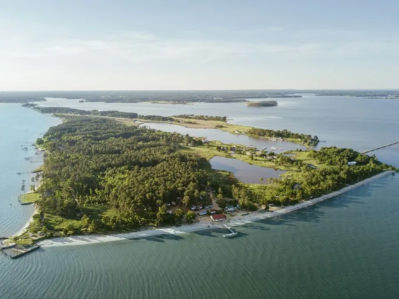
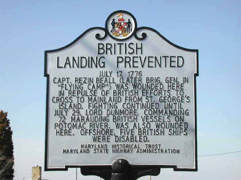
Today marks 250 years since British ships appeared off St. George Island, transforming a fishing and farming community into Maryland’s largest Revolutionary War battlefield. On July 15, 1776, just days after the Declaration of Independence was adopted, British forces arrived at St. George Island. What followed was a weeks-long military campaign that transformed a quiet landscape into a battlefield.
A study led by Preservation Maryland, Documenting and Exploring the Interpretive Potential of St. George Island: Maryland’s Largest Revolutionary War Battlefield, in association with Kennon Williams Landscape Studio, Washington College Center for Environment & Society, and Barton Ross & Partners, LLC, Architects, takes a deeper look at these events.
For generations, the events at St. George Island received only passing mention in histories of the Revolution. No comprehensive study had ever examined the battle through military records, archaeology, historic maps, and the landscape itself. This report is the first effort to reconstruct what actually happened and to identify where it happened.
The report reveals that understanding a battlefield requires more than identifying where shots were fired. It requires looking at the entire “battlescape,” the interconnected landscape of waterways, shorelines, roads, military positions, and resources that shaped the decisions of those who fought there.
A Battlefield Hidden
Battlefields are often thought of as places marked by monuments or preserved fields, but many historic conflicts survive in less obvious ways. The St. George Island study uses an interdisciplinary approach, combining military records, historical documents, archaeology, and environmental evidence to understand how the island functioned during the Revolution.
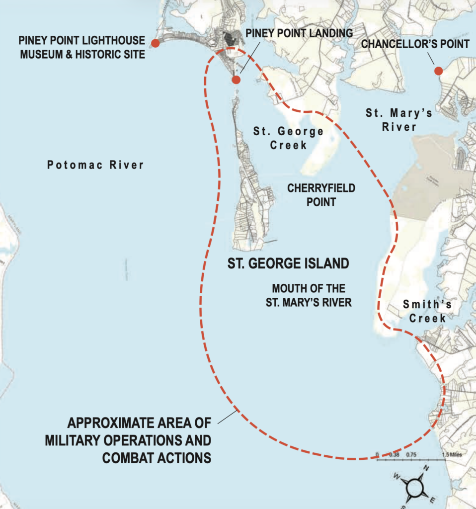
Researchers identified at least eleven key locations connected to the military operations of 1776, including areas tied to troop movements, naval activity, and resource gathering. The study shows that St. George Island was not an isolated event; it was part of a much larger military landscape stretching across the Potomac River and surrounding waterways.
More Than a One-Day Battle
For generations, accounts of St. George Island have often described a brief engagement. This research paints a much more complex picture. Rather than a single day of fighting, the campaign lasted 24 days, from July 14 through August 6, 1776, with additional salvage and recovery efforts continuing into the fall.
Contemporary accounts describe 70 to 80 British vessels entering the Potomac, an enormous naval force that immediately alarmed Maryland’s leaders. Although the fleet possessed overwhelming naval superiority, many of its ships were in poor condition and desperately needed fresh water, repairs, and supplies. The British objective was not to occupy Maryland permanently, but to secure critical resources, especially fresh water, for their ships and forces. Americans quickly recognized the threat and responded by mobilizing forces. The goal was to deny the British access to supplies, disrupt their operations, and force them away from Maryland’s shores.
The resulting confrontation demonstrated the importance of local knowledge and landscape. The waterways that gave the British mobility also created challenges, while Maryland militia used the island’s terrain to their advantage. The study also demonstrates that the island itself shaped the battle. Marshes, beaches, wooded areas, and the surrounding waterways all influenced where troops could land, move, hide, and fight. Rather than serving as a backdrop, the landscape was an active participant.
Both Sides of the Story
One of the most important contributions of this study is its examination of both the American and British forces involved. Earlier accounts often focused primarily on the Maryland militia response. This research expands the story by considering the organization, experience, equipment, tactics, and objectives of both sides.
Preserving the Battlefield of the Future
How we protect and interpret a battlefield that is still a living landscape
Researchers recommend that future interpretation focus on accessible locations near the island, including sites such as Piney Point Landing, the Piney Point Lighthouse Museum and Historic Park, and Chancellor’s Point at Historic St. Mary’s City. The study emphasizes the importance of respecting the rural character of St. George Island itself and protecting the community. Archaeological investigation will be critical in the years ahead. As erosion, rising waters, and development continue to change the landscape, archaeology offers an opportunity to document and preserve the stories that remain beneath the surface.
250 Years Later
Two and a half centuries later St. George Island still has stories to tell. Because so much of the battlefield survives beneath today’s landscape, the study provides a roadmap for future archaeological work. Every shoreline lost to erosion and every new construction project has the potential to erase pieces of Maryland’s Revolutionary story before they are fully understood. That opportunity also comes with urgency. Continuing to preserving St. George Island requires safeguarding the evidence that allows us to connect with the people, decisions, and events that shaped the nation’s earliest days.